14.5 km | 23 km-effort
Alta Via dei Parchi: Tappa 19
SityTrail - itinéraires balisés pédestres
Tous les sentiers balisés d’Europe GUIDE+
Length
8.3 km
Max alt
1049 m
Uphill gradient
583 m
Km-Effort
15.7 km
Min alt
500 m
Downhill gradient
446 m
Boucle
No
Signpost
Creation date :
2022-02-15 13:14:17.207
Updated on :
2022-03-01 11:17:45.694
3h33
Difficulty : Easy
FREE GPS app for hiking
About
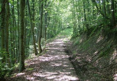
Trail On foot of 8.3 km to be discovered at Emilia-Romagna, Forlì-Cesena, Portico e San Benedetto. This trail is proposed by SityTrail - itinéraires balisés pédestres.
Positioning
Country:
Italy
Region :
Emilia-Romagna
Department/Province :
Forlì-Cesena
Municipality :
Portico e San Benedetto
Location:
Unknown
Start:(Dec)
Start:(UTM)
715572 ; 4873345 (32T) N.
Comments
Trails nearby
Un grande anello sopra a Castel dell’Alpe
On foot
Medium
Portico e San Benedetto,
Emilia-Romagna,
Forlì-Cesena,
Italy
5h 12min
Yes
Da Bocconi verso i Monti Gemelli
On foot
Medium
Portico e San Benedetto,
Emilia-Romagna,
Forlì-Cesena,
Italy
11.2 km | 22 km-effort
4h 54min
No
L’Acquacheta e il Monte Lavane
On foot
Medium
Marradi,
Tuscany,
Metropolitan City of Florence,
Italy
14 km | 25 km-effort
5h 43min
No
L’anello classico dell’Acquacheta
On foot
Easy
Portico e San Benedetto,
Emilia-Romagna,
Forlì-Cesena,
Italy
10.3 km | 17.1 km-effort
3h 53min
Yes
Tra i giganti della Val Tramazzo
On foot
Easy
Portico e San Benedetto,
Emilia-Romagna,
Forlì-Cesena,
Italy
8.5 km | 14.7 km-effort
3h 19min
Yes
Per andare a Monte dei Gralli
On foot
Easy
San Godenzo,
Tuscany,
Metropolitan City of Florence,
Italy
12.2 km | 18.3 km-effort
4h 8min
Yes
Valli selvagge tra Rabbi e Montone
On foot
Medium
Portico e San Benedetto,
Emilia-Romagna,
Forlì-Cesena,
Italy
15.6 km | 31 km-effort
7h 1min
No
L'Acquacheta e l'Alto Tramazzo
On foot
Easy
Marradi,
Tuscany,
Metropolitan City of Florence,
Italy
10 km | 16.3 km-effort
3h 41min
No
Sentiero Natura Acquacheta
On foot
Easy
San Godenzo,
Tuscany,
Metropolitan City of Florence,
Italy
4.6 km | 5.7 km-effort
1h 17min
No